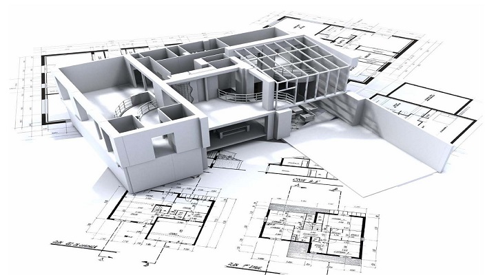
CAD Drafting
We are also providing the similar kind of services in the below areas where we are drafting the assets and their network based on the specification mentioned by the client.
- Civil Drafting Floor Plans, Building Layouts, Societies, University Complexes.
- Electrical Drafting Substation Drawing, LT & HT Drafting, Asset Placement ( Transformer, Pole, Guy, Anchor, Insulator) as per Dimensional info or Business Rules, Internal Electrical Layouts of Buildings.
- Telecom Drafting Central office, Copper, Fiber Cables, Under Ground/Aerial/Buried, Asset Placement ( Pillar, DP, Splitter, Manhole) as per dimensional info or as per Business Rules, Internal Electrical Layouts.
- HVAC Duct Layout Creation Duct layout Designing, As built Updating.
CAD Data Extraction,Conversion and Migration
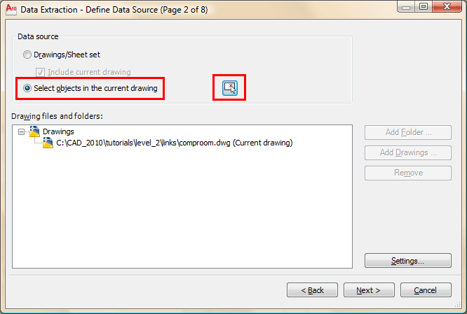
We have the skills by which we can extract the cad data and can process, convert, Migrate into any third party software like ( ARC GIS, Oracle, Geodatabase or clients system) using some manual as well as automated procedures.
We can convert and migrate Cad data into GIS Data using Geodatabase concept to use the power/Benefits of GIS . this will help the service provide to enjoy the power of GIS softwares like versioning , On the fly editing, updating, Viewing, to enjoy the seamless view of the entire data
While extraction we maintain the integrity of the data to the full extent as expected by the customer.
We do use some process in order to clean, correct and improve the Graphical as well as logical data in order to achieve the completeness and correctness of the data.
We can extract any piece of info like annotation, text, logical/area etc from the cad file and can associate with the connected/relevant elements of the drawing as attribute or logical info.
We can convert the cad data of any sector (Civil, Electrical, Oil , Gas, Telecom) of any area of the globe and can migrate to Arc Gis Geodatabase .
We can extract the data by digitizing, Drafting from any source format like ( PDF, JPG, IMG, TIf , xls, Visio,
Polylining & Square Footage Calculation
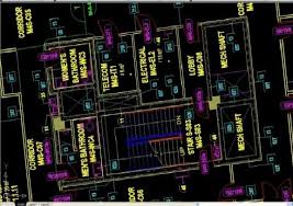
For some of the Clients in the Civil Sector/Real Estate Sector we are providing these kind of services as well to manage & make the optimum utilization of their office space accordingly. In this area we are sometimes converting the legacy sources of the client or drafting the floor plans /layout plans and offices in order to get the best ever measurements of the spaces he is utilizing or having. We provide our customers the actual Square Footage of the usable or unusable areas.
The needs or requirements differ from client to client; taking the experience and the requirement from the customer we start this exercise by doing Polylining for the required area which does help us to know and record the square footage for that used area. Currently while doing this exercise we have seen there are two main standards getting used globally, one of which is known as IFMA ((IFMA, International Facility Management Association (formerly National Facility Management Association ) & other is known as BOMA (Building Owners and Managers Association. BOMA, Building Owners Management Association) It depends upon the customer what standard he is following which does depend on his needs. We at VS proceed with any of the two whichever client is expecting in any particular project or Opportunity.